Accurate Population Insight Before Management Begins
Effective deer management starts with accurate information. Assumptions and anecdotal estimates are not sufficient when estates require structured, accountable outcomes.
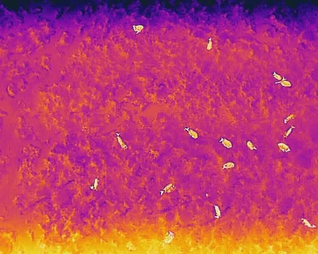
Dixon Deer Management uses thermal drone technology alongside ground assessment to establish clear population data and density mapping before any management plan is implemented.
Data-Led Assessment
Thermal drone surveys allow us to assess deer numbers with greater accuracy, particularly in woodland or low-visibility environments where traditional observation may undercount populations.
This approach provides:
- More reliable population estimates
- Density mapping across defined areas
- Identification of movement patterns
- Improved understanding of high-impact zones
Accurate data ensures that management decisions are proportionate, justified and aligned to estate objectives.
Informing a Structured Management Plan
Survey findings form the foundation of a tailored deer management programme. Rather than reacting to visible damage alone, we develop plans based on measurable population insight and long-term habitat considerations.
This enables estates to demonstrate that deer management activity is evidence-based and strategically planned.
Professional & Compliant Operation
All drone operations are conducted in accordance with current regulations and licensing requirements. Our approach combines modern surveying capability with practical field experience to deliver accurate, responsible assessment.